
Medium airport · Kapolei, United States
Kalaeloa Airport
Kalaeloa Airport is a medium airport serving Kapolei, United States. Its IATA code is JRF. Its ICAO code is PHJR. It has 3 runways, longest 8,365 ft (ASP). Elevation 30 ft.
No freely licensed photograph of this airport is in our library yet — rather than borrow a picture of somewhere else, this profile leads with its verified facts.
Airport facts
| Location | Kapolei, United States |
|---|---|
| IATA code | JRF |
| ICAO code | PHJR |
| Type | Medium airport |
| Runways | 3 runways, longest 8,365 ft (ASP) |
| Elevation | 30 ft |
| Coordinates | 21.3074° N, 158.0700° W |
Every fact above is taken from the sources listed below; anything no source states is left blank rather than guessed.
History
Kalaeloa Airport (IATA: JRF, ICAO: PHJR, FAA LID: JRF), also called John Rodgers Field (the original name of Honolulu International Airport) and formerly Naval Air Station Barbers Point, is a joint civil-military regional airport of the State of Hawaiʻi established on July 1, 1999, to replace the Ford Island NALF facilities which closed on June 30 of the same year. While Kalaeloa Airport is primarily a commuter facility used by unscheduled air taxis, general aviation and transient and locally based military aircraft, the airport saw first-ever scheduled airline service begin on July 1, 2014, with Mokulele Airlines operating flights to Kahului Airport on Maui.
Official website: http://airports.hawaii.gov/jrf/ — the airport's own site has the current flight and visiting information.
Landmarks near this airport
Famous landmarks close to Kalaeloa Airport, by straight-line distance — each link opens its profile on our sister site LandmarkProfiles.
- Waikiki Beach · United States · 15.5 miles away
- Diamond Head · United States · 17.3 miles away
National parks near this airport
National parks close to Kalaeloa Airport, by straight-line distance — each link opens its profile on our sister site National Park Profiles.
- Honouliuli National Historic Site · United States · 5.9 miles away
- Pearl Harbor National Memorial · United States · 9.4 miles away
- Sand Island State Recreation Area · United States · 12.0 miles away
- Keaīwa Heiau State Recreation Area · United States · 12.8 miles away
- Heʻeia State Park · United States · 19.1 miles away
- Ahupuaʻa O Kahana State Park · United States · 20.2 miles away
Airports nearby
The closest airports in this library, by straight-line distance.
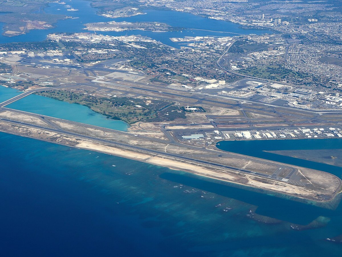
Daniel K. Inouye International Airport
9.3 miles awayWheeler Army Airfield
12.2 miles awayKawaihapai Airfield
20.5 miles awayKaneohe Bay MCAS (Marion E. Carl Field) Airport
21.8 miles awayMolokai Airport
63.6 miles awayMore airports in United States
More medium airports
Frequently asked questions
What is the airport code for Kalaeloa Airport?
Kalaeloa Airport — its IATA code is JRF and its ICAO code is PHJR.
Where is Kalaeloa Airport located?
Kalaeloa Airport serves Kapolei, United States. Its coordinates are 21.3074° N, 158.0700° W.
What is the history of Kalaeloa Airport?
Kalaeloa Airport (IATA: JRF, ICAO: PHJR, FAA LID: JRF), also called John Rodgers Field (the original name of Honolulu International Airport) and formerly Naval Air Station Barbers Point, is a joint civil-military regional airport of the State of Hawaiʻi established on July 1, 1999, to replace the Ford Island NALF facilities which closed on June 30 of the same year. While Kalaeloa Airport is primarily a commuter facility used by unscheduled air taxis, general aviation and transient and locally based military aircraft, the airport saw first-ever scheduled airline service begin on July 1, 2014, with Mokulele Airlines operating flights to Kahului Airport on Maui.
Sources
- https://davidmegginson.github.io/ourairports-data/airports.csv#5447
- https://en.wikipedia.org/wiki/Kalaeloa_Airport
Page last updated 13 November 2026.