
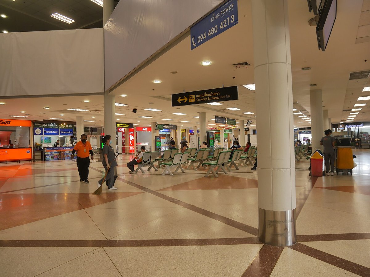
Large airport · Chiang Mai, Thailand
Chiang Mai International Airport
It is a major gateway that links northern Thailand to the rest of the region and is currently the fourth-busiest airport in the country. Its IATA code is CNX. Its ICAO code is VTCC. It has 1 runway, longest 11,155 ft (ASP). Elevation 1,036 ft.
Photo: กสิณธร ราชโอรส via Wikimedia Commons, CC BY-SA 4.0. Cropped and resized for display.
Airport facts
| Location | Chiang Mai, Thailand |
|---|---|
| IATA code | CNX |
| ICAO code | VTCC |
| Type | Large airport |
| Runways | 1 runway, longest 11,155 ft (ASP) |
| Elevation | 1,036 ft |
| Scheduled service | Yes |
| Coordinates | 18.7668° N, 98.9626° E |
Every fact above is taken from the sources listed below; anything no source states is left blank rather than guessed.
What Chiang Mai International Airport is known for
It is a major gateway that links northern Thailand to the rest of the region and is currently the fourth-busiest airport in the country.
National parks near this airport
National parks close to Chiang Mai International Airport, by straight-line distance — each link opens its profile on our sister site National Park Profiles.
- Doi Suthep-Pui National Park · Thailand · 4.2 miles away
- Op Khan National Park · Thailand · 8.3 miles away
- Mae Wang National Park · Thailand · 23.0 miles away
- Khun Khan National Park · Thailand · 23.1 miles away
- Doi Khun Tan National Park · Thailand · 28.2 miles away
- Doi Inthanon National Park · Thailand · 30.1 miles away
Airports nearby
The closest airports in this library, by straight-line distance.
More airports in Thailand
More large airports

Frequently asked questions
What is Chiang Mai International Airport?
It is a major gateway that links northern Thailand to the rest of the region and is currently the fourth-busiest airport in the country.
What is the airport code for Chiang Mai International Airport?
Chiang Mai International Airport — its IATA code is CNX and its ICAO code is VTCC.
Where is Chiang Mai International Airport located?
Chiang Mai International Airport serves Chiang Mai, Thailand. Its coordinates are 18.7668° N, 98.9626° E.
How high is Chiang Mai International Airport?
Chiang Mai International Airport sits at 1,036 feet above sea level.
Sources
- https://davidmegginson.github.io/ourairports-data/airports.csv#26647
- https://en.wikipedia.org/wiki/Chiang_Mai_International_Airport
Page last updated 13 November 2026.